Thunderstorm chances increase this week
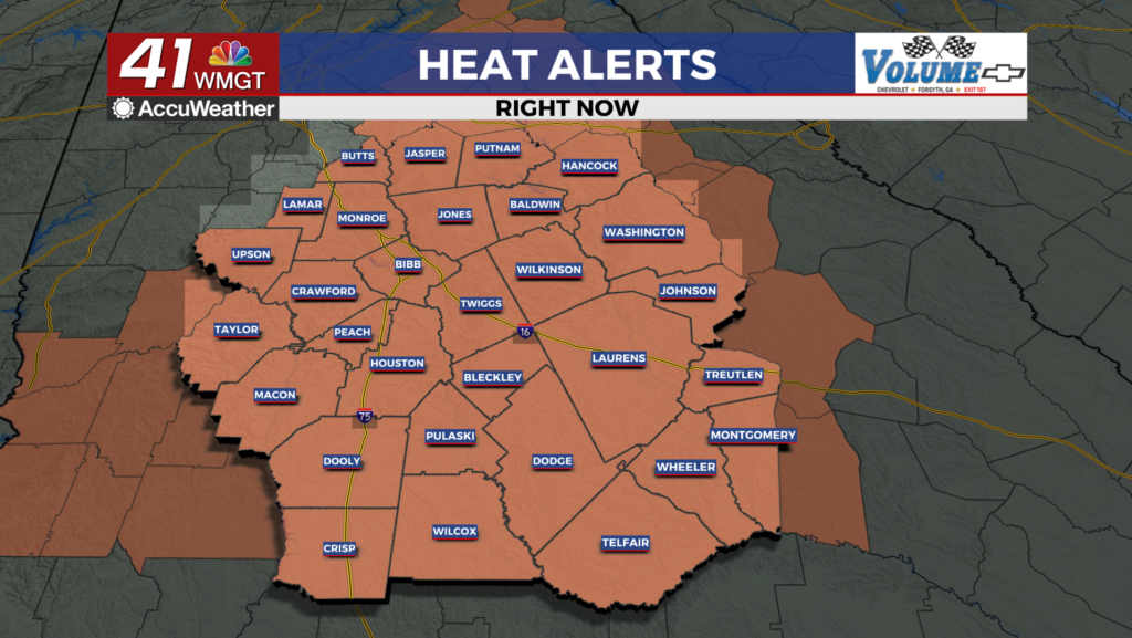
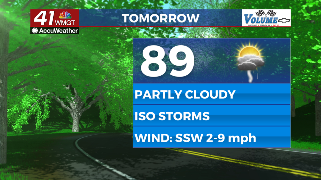
MACON, Georgia (41NBC/WMGT) – A Heat Advisory has been issued for most of Middle and East Central Georgia until 8 pm this evening. Starting off with a fairly rinse and repeat conditions today. Modest high pressure and ridging keeps temperatures hot with flow from the West to Southwest. 


 Dewpoints in the 70s and temperatures in the mid to upper 90s will mean feel like temperatures could reach over 105 degrees for extended periods! Precipitation chances Monday will be limited, particularly in Western Georgia where the high is stronger though isolated to scattered thunderstorms will be possible in eastern and far northern coverage areas. A few storms could become strong with gusty winds, frequent lightning, and heavy rainfall. Conditions change Tuesday as we watch for an area of modest tropical development off the Georgia/Florida coast. Models are in fairly high agreement given the fact that this feature hasn’t yet formed. Let’s assume that something forms. This feature will drift along the base of a high bringing southeast flow into the area. This flow will be very moist, and will likely trigger a slow moving (possibly stationary) line of thunderstorms stretching from northeast to the southwest. The exact location of this feature will be in question until the tropical low becomes apparent, however, current models really want to set this up along the I-85 corridor including the Atlanta metro. Although flow isn’t strong, definitely remain vigilant of slow moving rainmakers in urban areas. Heat indices on Tuesday will be dependent on thunderstorm coverage. Areas that do not receive precipitation or cloud coverage could be hot. Be prepared for Heat Indices of 105 to 110 through mid week.