Hot temperatures and spot storms arrive in time for the weekend
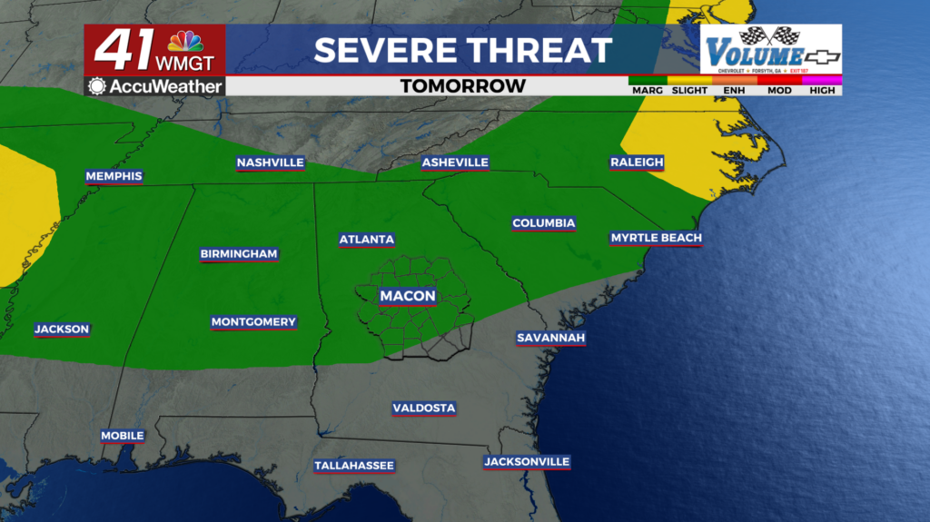
MACON, Georgia (41NBC/WMGT) – High pressure is in control over the southeast region. Cloud cover tapers off for most of the state except for high level cirrus clouds. We also have a large 


 area of dry air in the mid levels of the atmosphere which also indicates high pressure being in place. With this high pressure pushing in today as well ahead of the next system, temperatures will rise into the low to mid 90s across the area. For the rest of the today expect dry conditions. The transition period from Friday overnight into Saturday morning is when the next system pushes into the area. An upper level low pushes into the Great Lakes region while an attached cold front pushes into North Georgia by late Friday night. Into early Saturday morning precipitation chances increase to 30-40% where the front begins moving into the area. The Storm Prediction Center has outlined our area in a Marginal (Level 1 of 5) Risk at this time, however, the fact that the system may arrive overnight versus afternoon, this risk should remain low.