Rain chances increase Wednesday and remain throughout the week
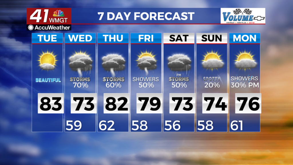
MACON, Georgia (41NBC/WMGT) – The overall pattern has a funneling of dry air resulting from a ridging over the Plains into the southeast and much of north and Middle Georgia. Rain chances 

 remain limited until this block breaks down and another low pressure system over the west pushes east into the area on Wednesday. Wednesday morning rain chances increase from the west as the low pressure system moves eastward. Temperatures will be mostly seasonable with highs in the 70s and lows in the 50s. An increase in moisture accompanied by modest increase in instability on Wednesday will result in a return of precipitation chances. The upper level low is forecast to move away from the area, swept up into the trough over Hudson Bay, with a strengthening jet behind it. Disturbances will be pulled across the area from the west/southwest through the end of the week. This will result in a gradual deepening trough flow over the Gulf to east of the Carolinas. Showers and thunderstorms are likely each day and are likely to last into the weekend.