Unsettled pattern comes to an end on Tuesday
MACON, Georgia (41NBC/WMGT) – A surface high in the Atlantic and upper level ridging dominates the weather for Middle Georgia. Starting Tuesday, dewpoints will begin to recover 
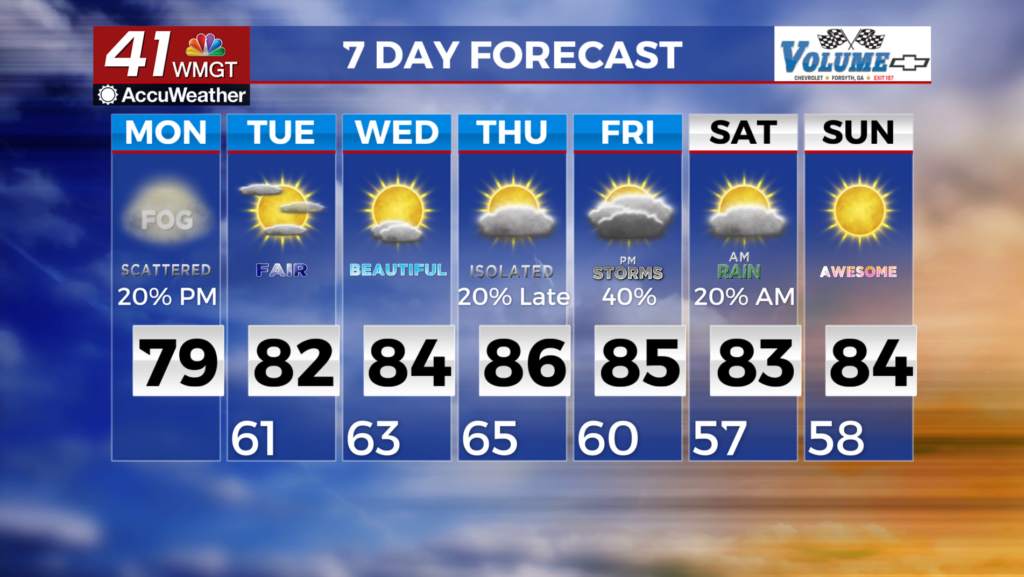
 in western Georgia as the surface high drifts east and southeasterly winds take on a more southerly component. This should combine with daytime heating to increase instability in the afternoon and evening, and may lead to isolated thunderstorms. At this time we are not looking at no severe weather potential with any storms that pop up. Temperatures should be 3 to 7 degrees above average Tuesday and 5 to 10 degrees above average Wednesday. This should shape up to lower 80s Tuesday and mid 80s Wednesday.