Cooler temperatures over the next two days
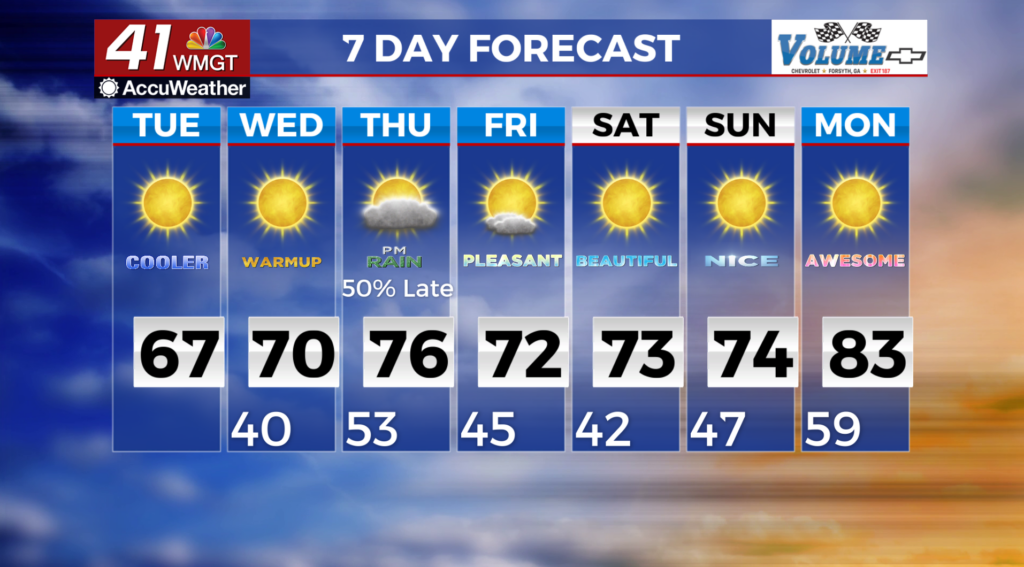
MACON, Georgia (41NBC/WMGT) – A surface high builds into the Tennessee Valley Tuesday and Tuesday night. Ahead of this feature, northwest winds will usher in a colder and 
 drier airmass into Georgia. This could be the set up for freezing or near freezing temperatures in the northern portion of the state Tuesday night and Wednesday morning. A Freeze Watch has been issued along and north of Interstate 85. South of the watch area may likely get frost formation Tuesday night. The cautionary is the wind, which may remain in the 2 to 7 mph range tonight. That would impact radiational cooling and hinder temperature declines. The next trough and associated cold front will move through the region between Thursday afternoon and Friday. The passage of this system will bring with it a chance for rainfall and isolated thunderstorms. An isolated strong storm can’t be ruled out Thursday night or Friday. However, with limited moisture return, and instability for the storm to work with, this should limit severe weather potential.