Foggy start then warmer temperatures
MACON, Georgia (41NBC/WMGT) – A weak disturbance rounding the northwestern edge of a Bermuda High provides support for isolated showers and thunderstorms across portions 
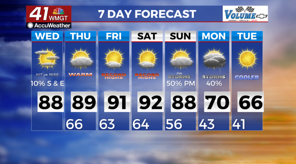
 of north and east Middle Georgia. This will make for a rather dreary conditions for areas to the north and east of the Atlanta metro. Breezy to gusty conditions are likely, with the highest gusts to the north and west, as a surface pressure gradient (winds) increase ahead of a strong low pressure system lifting northward across the Plains. Due to increased cloud cover and moisture return occurring overnight, expect lows to be as much as 10 to 15 degrees warmer than last night, dropping into the lower 60s. Highs will depend on the progression of the wedge airmass in the 60s to 70s for points north and east of Atlanta, and in the 80s to near 90 everywhere else. That’s 12 to 18 degrees above average for early April. Expect possibly record-breaking temperatures beginning Thursday.