
All eyes on Eta in the Gulf
MACON, Georgia. (41NBC/WMGT)- Tropical Storm Eta will make a second U.S. landfall this week.
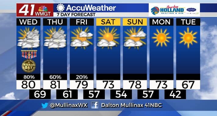
TODAY.
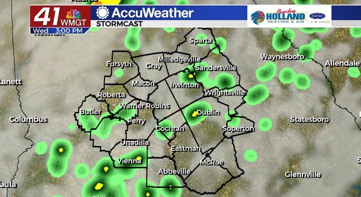
Ahead of a cold front moving in from our west, we will have ample moisture across our area available for scattered downpours. It’ll be another warm afternoon as well. Temperatures will climb into the upper 70’s and lower 80’s under a mostly cloudy sky. Isolated showers will hang around overnight as temperatures only fall into the upper 60’s.
TOMORROW.
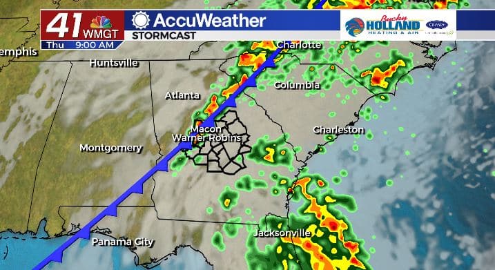
A cold front will move through tomorrow bringing another round of locally heavy downpours to the area. A mix of sun and clouds is expected tomorrow afternoon as temperatures climb into the low 80’s.
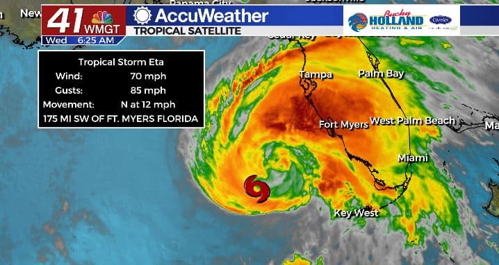
Eta is expected to make landfall Thursday on Florida’s Gulf Coast. With this particular track, our impacts will be minimal from the system. We will keep a close eye on this track in the coming hours.
FRIDAY & BEYOND.
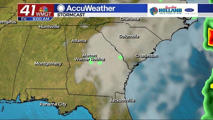
A few showers may linger through Friday., but beyond that we look to dry out in time for the weekend. Another cold front will move through that will send temperatures back into the 60’s by Tuesday.
Follow Meteorologist Dalton Mullinax on Facebook (Dalton Mullinax 41NBC) and Twitter (@MullinaxWX) for weather updates throughout the day. You can also watch his forecasts Monday through Friday on 41NBC News at Daybreak (6-7 a.m.) and 41Today (11 a.m).

Leave a Reply