

Temperatures on the rise ahead of Hurricane Delta
Middle Georgia saw a few isolated showers today as we got our first surge of moisture for the week.
Wednesday will bring another warm day to Middle Georgia as we warm into the Middle 80’s, and yeah, the humidity is sticking around tomorrow as well.
Our weather stays pretty boring until Friday when we start to see our first impacts from Hurricane Delta.
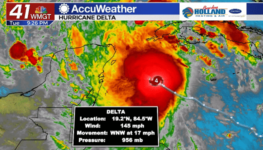
As of the 8pm update, Delta is a very dangerous Category 4 hurricane with winds of 145 mph. We could still see some more intensification overnight ahead of the first landfall of Delta.

The path for Delta will bring it through the Yucatan peninsula, likely impacting Cancun. Then Delta will be able to sit over the Gulf of Mexico for a bit to strengthen back to a Cat. 4.
Landfall for the US is forecast for overnight Friday/early Saturday along the Louisiana coast.
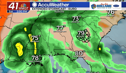
As early as Friday afternoon/evening and definitely by Saturday we will start to see the impact of the outer bands of Delta. Impacts through the end of the weekend could include tropical downpours, isolated spin-up tornadoes, and gusty winds.
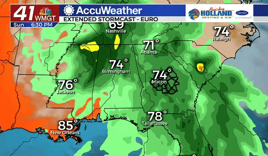
Pockets of heavy rain will be possible through Sunday as the center of circulation for Delta will be passing to the north.
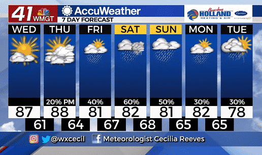
Highs over the weekend will be cooling into the low 80’s with clouds expected through the end of the weekend.
By next week our rain chances will be winding down ahead of another cold front that is forecast to swing through by mid-week.
All eyes are going to be on Delta this week and the forecast path will likely change by the end of the week, so make sure you stick with 41NBC for updates.
Leave a Reply