More rain and storms possible Friday in Middle Georgia
It has been a rainy afternoon across Middle Georgia and that will be continuing through much of Friday.
A warm front will be pushing north and bringing more rain and better storm chances to the area. A few pockets of heavy rain will be possible through the day tomorrow.
Isolated severe storms will be possible in Middle Georgia, mainly Friday afternoon. Because of timing of these storms, most of the severe threat will be to the east of I-16.
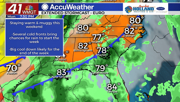
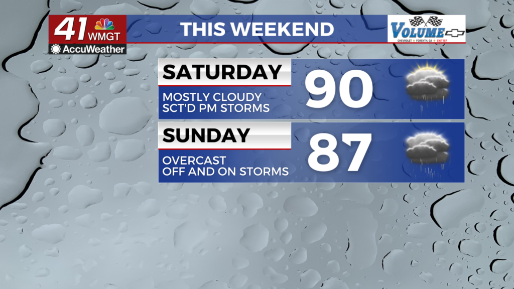
Scattered showers and storms will be possible through the weekend, but don’t expect a rain-out either day. Highs over the weekend will warm into the mid 80’s with high humidity sticking around as well.
We will finally see some relief from the heat at the start of next week. Rain and a cold front will be moving through to start the week. This will be a pretty weak front, but it will cool us down a bit to the 70’s.
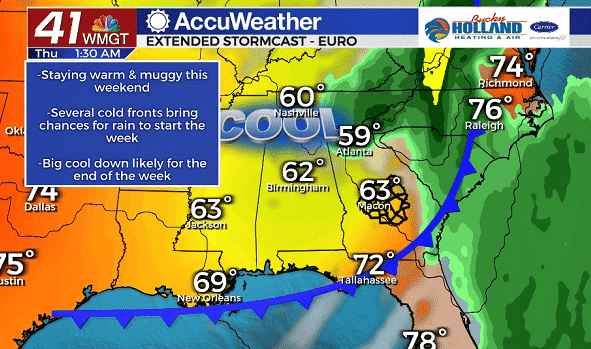
The big show moves in Tuesday-Wednesday (there is still some model discrepancy) which could bring some heavy rain (like I said, model discrepancy). What we are pretty sure about though, is that a big cool down will follow this front.
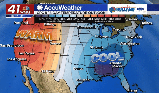
This cold front will bring a big cool down for a prolonged period. Not only will we be cooling down, we will be drying out for the start of October.
Still a good bit to work out with this forecast, but all signs are pointing to a nice start to October.


Leave a Reply