
Cooler temperatures and increased rain chances return to Middle GA
Showers and storms have finally fired up in Middle Georgia this evening and as expected there is heavy rain and some frequent lightning to go along with it.
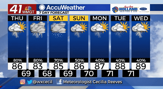
Tomorrow will finally bring a cool down across the area thanks to a trough and the entrance of the jet for a few days. Highs will be limited to the mid 80’s thanks to some cooler air aloft and increased cloud cover. 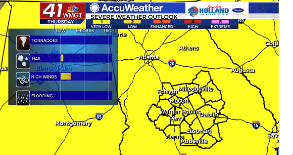
Showers and thunderstorms will be likely by tomorrow afternoon and evening. Some of these could be strong to severe. Damaging winds will be the main threat tomorrow with a small chance of hail.
As we head through the rest of the week rain chances stay likely, especially in the afternoon and evening. High temps will be staying mainly in the 80’s, but humidity will remain high.
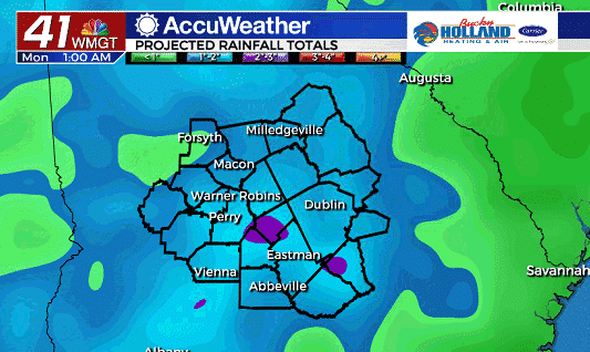
With this rain lasting through the weekend, expect rainfall totals to be 1-3″ between now and Monday. Of course rain totals will be higher in strong storms.
Next week brings probably more questions than answers as much of the forecast will be dependent on what ends up happening in the tropics.
We continue to monitor the situation, but right now it looks like there is not an immediate threat to our area. The earliest we could see an impact will be next week.

Leave a Reply