


Front stalls near Middle Georgia, scattered storms stick around
Well Middle GA got one day of dry conditions on Sunday, but storms were back once again today. These storms approached along a weak cold front that, unfortunately, stalled just north of our area.
Tomorrow this stationary boundary will be the axis of activity that will bring another chance of scattered showers and storms by the afternoon. 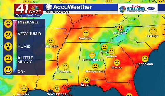
Unfortunately the dry/comfortable air will be stuck just north of the front. Much of Middle GA will still be quite humid tomorrow, but thankfully it won’t be quite as hot (which is a nice trend through the rest of the week.
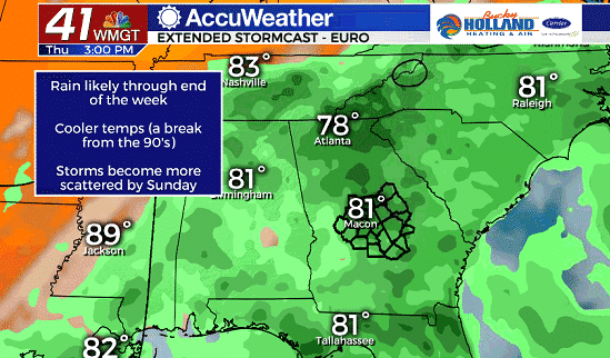
Storms become more widespread as we head through the rest of the week. Expect mainly off and on showers and storms beginning Wednesday afternoon.
This rain will likely stick around through the end of the week. Although many of us are tired of the rain, it will keep us cooler than normal with highs in the mid 80’s.
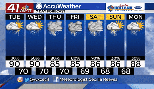
Rain and storms will likely stick around at least through the beginning of the weekend. The end of the weekend will likely bring scattered showers and storms, but all of this can change depending on what happens in the tropics.
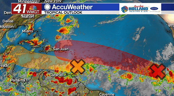
Things in the tropics are heating up pretty quickly and we are currently watching two systems very closely.
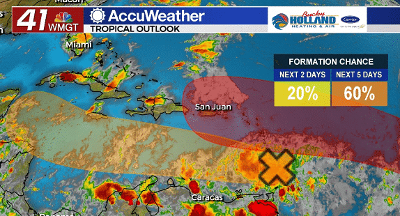
The system closest to the gulf has a medium chance for tropical development in the next 5 days.
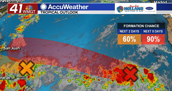
The more robust looking system further off in the Atlantic looks a bit more organized and has a high chance of tropical cyclone development by the end of the week.
Although some forecasts bring these systems to the US that are still quite a few unknowns. We are likely not going to have a good idea about the forecast until later in the week or by the weekend.

Leave a Reply