
Storms likely in Middle Georgia Saturday
More showers and thunderstorms are on the way as we head through the weekend thanks to a low pressure center just to our north.
We will continue to see Gulf moisture being shuttled into the area though the day on Saturday which will translate into storms with the potential for heavy rain and lightning.
Expect off and on showers throughout the day and into the evening.
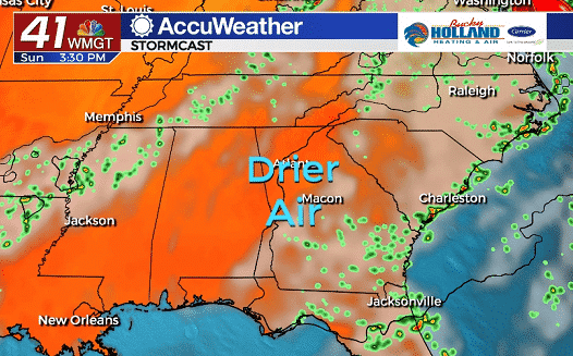
By Sunday the low pressure center will move out of the area, taking much of the enhanced gulf moisture with it.
Dry air will begin to move in Sunday, which will limit our rain chances to just isolated showers and will allow temperatures to warm into the mid 90’s.
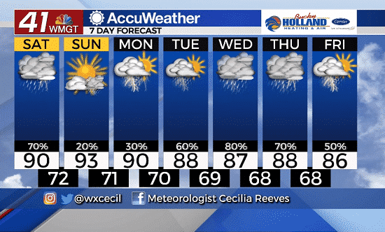
The start of next week will bring a chance of scattered showers and storms, with our last day of 90’s for a little while.
Beginning Tuesday we will start to increase our rain and storm chances. Highs will be limited to the upper 80’s and lows will begin to fall into the 60’s (hooray!!).
The middle of next week will not only bring increasing rain chances, but also high temps that are lower than normal for this time of year.
While there are still some forecast pieces to work out, in general, expect a rainy week with some cooler temps.

Leave a Reply