
Heat and humidity stick around this week
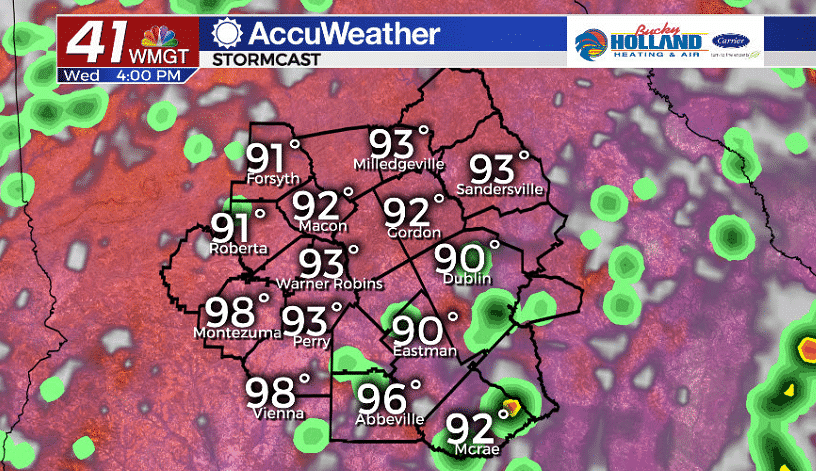
It was another hot day in Middle Georgia with highs in Macon topping out at 99. Thankfully with the storms this afternoon we got a nice cool down for the evening.
Even with the cool down, we will be seeing the potential for some patchy fog to develop overnight and into tomorrow morning.
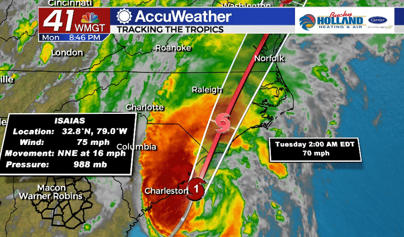
This evening we are also monitoring Isaias, which is now a hurricane as it makes landfall, likely in South Carolina. As Isaias pushes north it will bring the possibility of heavy rain, gusty winds, and tornadoes to parts of the east coast.
Middle Georgia likely won’t see much of an impact from Isaias, but if you are traveling anywhere along the east coast, north of the Carolinas tomorrow, you will likely have to deal with this.
Back at home we are going to continue to deal with more of the same as far as heat, humidity and pop up showers and storms.
Highs will be in the mid 90’s and our “feels like temps” will warm up to the upper 90’s and triple digits.
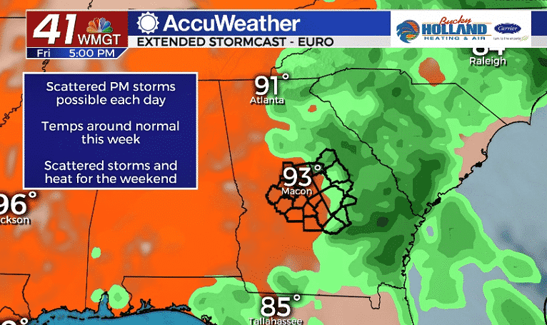
As we head into the weekend, don’t expect much in the way of a pattern change. Highs will remain in the mid 90’s through the weekend with rain chances hanging on as well.
Next week looks likely to bring more rain and storm chances, but not much cooler temperatures.

Leave a Reply