


More triple digit heat possible Tuesday
Today we saw our first day this year of triple digit heat in Macon (and Milledgeville). Unfortunately it won’t likely be a one off, with more heat on the way tomorrow.
High pressure is situated over Georgia which is keeping it toasty for the next few days. Highs will stay in the upper 90’s with even a few 100’s possible by tomorrow afternoon.
Scattered storms will be possible once again in Middle Georgia to hopefully help us cool down a bit.
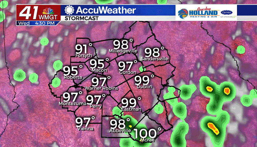
Wednesday will be another hot day with a chance for showers and storms through the afternoon. Although it will be hot, I anticipate a slight cool down for areas north of Dublin.
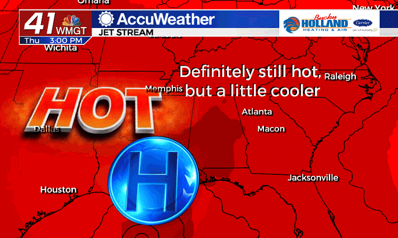
By the end of the week high pressure pushes further away from Middle Georgia and as it does, some of the intense heat will begin to wane.
We will still see highs in the mid 90’s, but at least it won’t be in the hundreds. We are taking the small victories here, it is 2020.
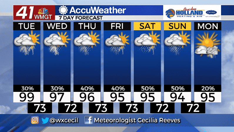
The weekend will bring increasing rain chances as a cold front tries to approach. If we can get enough rain and storms in the area, we should be able keep our temps a little bit cooler Saturday and Sunday.
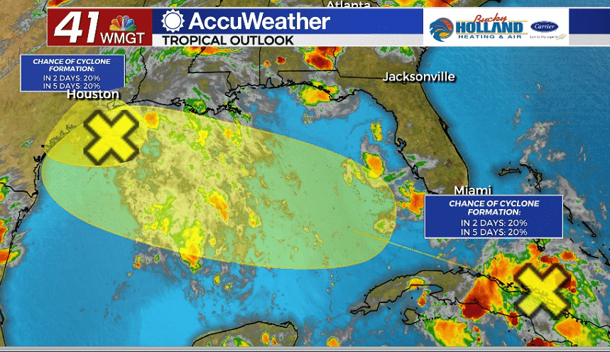
We are also monitoring a few tropical waves, but as of right now, there is not much to worry about. For the next days, these tropical waves have only a 20% chance of cyclone formation.
Just a reminder that the tropical season is about to shift into high gear.

Leave a Reply