
Storm chances increase and heat sticks around through the week
It was a scorcher across Middle Georgia today, with highs in the mid 90’s and “feels like” temps in the 100’s!
High pressure to our south will continue to pump Gulf moisture into the area, which means humidity will be high. We will also see another hot day, with mid 90’s returning to the area by mid day.
By late tomorrow afternoon, pop up showers and storms are expected. Main threats from storms Tuesday (and the rest of the week) will be damaging wind gusts as well as the chance for hail.
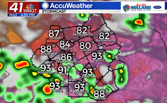
Wednesday, expect more of the same. Partly cloudy skies will give way to highs in the mid 90’s and more widespread coverage of storms by the afternoon.
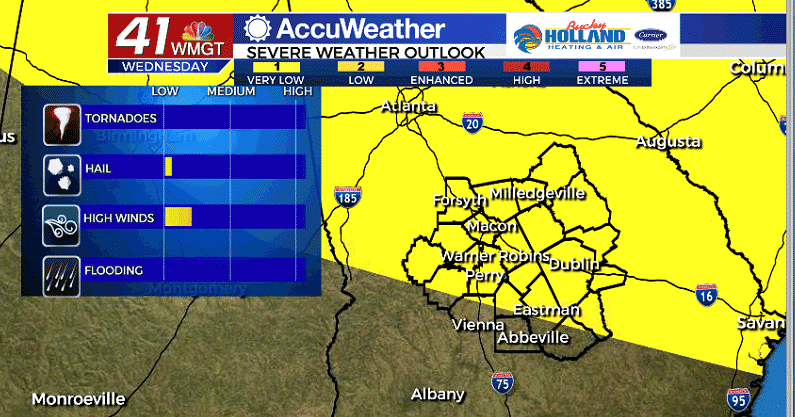
The Storm Prediction Center has already placed Middle GA under a level 1 threat for Wednesday. This means most of the area will be at risk of severe storms. Stay weather aware if you are going to be outdoors this week.
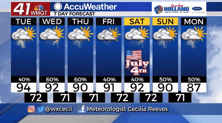
Storms will be possible through the afternoon and evening through the next 7 days. Thursday looks to be the rainiest day of the week, with widespread rain and storms.
The 4th of July remains a pretty questionable forecast. Right now, it looks like it won’t be a total rain out, but we will be doding showers and storms through much of the afternoon and evening.

Leave a Reply