
Weekend brings warm weather and a few showers
Fog kind of took over our weather for the start of the day on Friday, but sunshine returned and helped to warm us into the 80’s on Friday.
For Saturday expect another day that starts with the potential for patchy fog as well as unseasonable warmth. This will likely be the warmest day we see for a while.
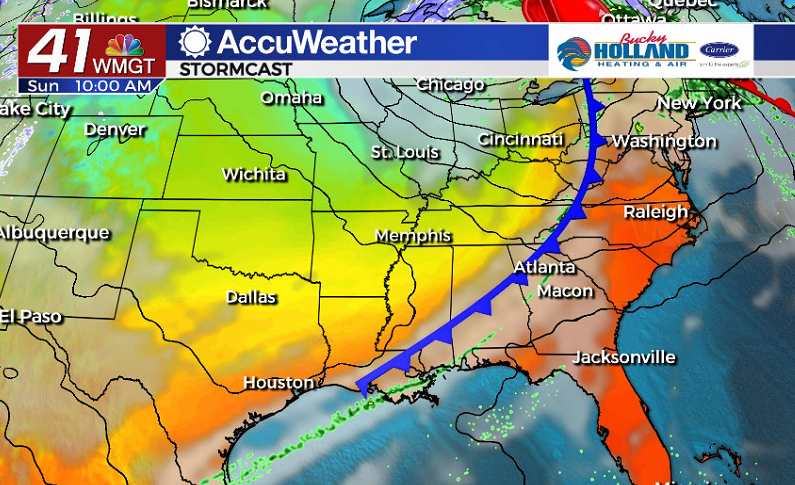
Sunday will bring more cloud cover to the area, but also a chance of isolated showers and storms. Right now it looks like the moisture with the approaching cold front will run out by the time it makes it to Middle Georgia. This means our storm chances will be pretty limited.
Regardless of the storm chances, this front will bring big changes to the forecast, beginning with a cool down.
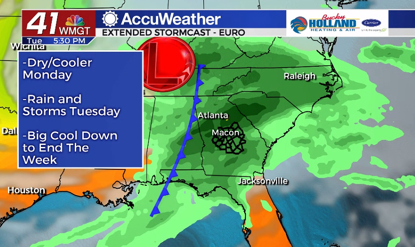
Monday will be a much cooler day across the area, thanks to the Sunday cold front. Monday will also be a dry day, but that will be short lived with more rain on the way by Tuesday.
The storm system on Tuesday will bring heavy rain as well as the potential for a few thunderstorms. Right now it is not looking like much of a severe threat, but we will be monitoring it.
Behind this front we will see a significant cooling that will likely hang around through the end of the week. Expect high temperatures in the upper 60’s and lows in the mid 40’s.
We will also see mostly dry conditions through the end of the week.

Leave a Reply