
One more wave of showers and storms today
MACON, Georgia. (41NBC/WMGT) – A wet and stormy work week will finally come to an end later tonight after one final round of showers and storms move through our area.
TODAY.

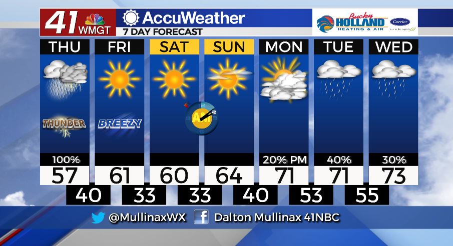
An area of low pressure will move across the Gulf Coast bringing with it another shot of showers and storms to Middle Georgia. The main storm threat today will be heavy rain as an additional 1-2″ are expected on top of already soaked soil. High temperatures will top out in the middle to upper 50’s today before overnight lows fall into the upper 30’s and lower 40’s.
As of 5 am on Thursday, March 5…
- A Flash Flood Watch is in effect through 7 pm
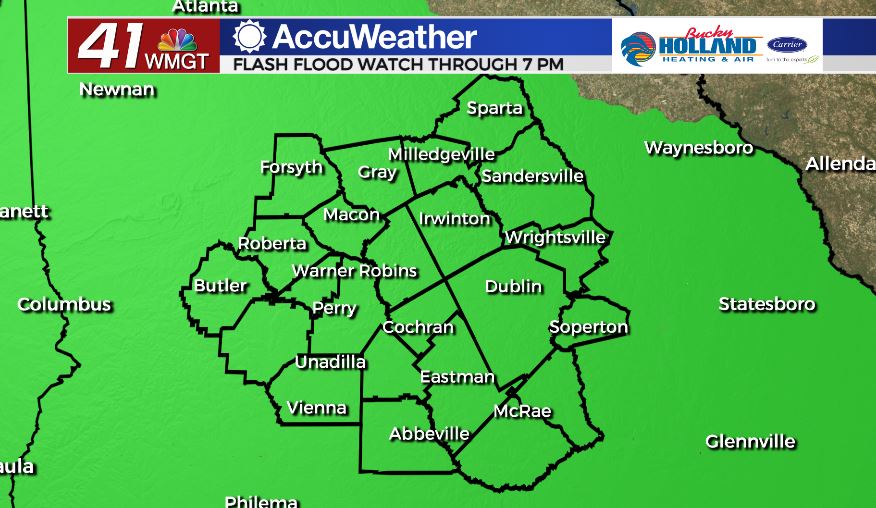
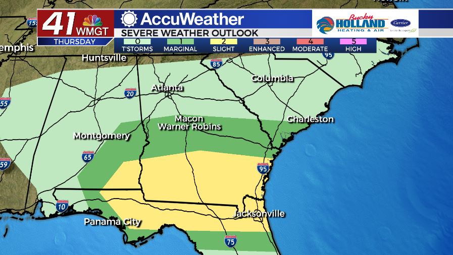
- The Storm Prediction Center has nearly all of Middle Georgia in a Marginal (level 1/5) risk area. While the greatest storm chances stays to our south today, an isolated strong storm or two cannot be ruled out for our area.
TOMORROW.
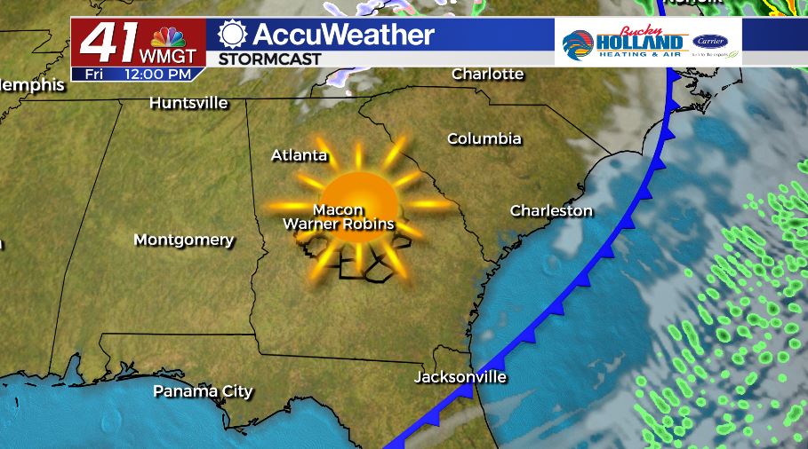
We FINALLY dry out as we head into the final day of the work week. Low pressure moves away and a cold front will sweep through the area allowing cooler and drier air to filter into the Peach State under a sunny sky. Temperatures stay in the upper 50’s and lower 60 for most of the afternoon before near-freezing temperatures move in overnight under a clear sky.
WEEKEND AND BEYOND.
The weekend will be great with temperatures in the 60’s and a lot of sunshine. By Monday morning, cloud cover will begin to work in ahead of our next frontal system that will move in late in the day on Monday and into Tuesday.
Follow Meteorologist Dalton Mullinax on Facebook (Dalton Mullinax 41NBC) and Twitter (@MullinaxWX) for weather updates throughout the day. You can also watch his forecasts Monday through Friday on 41NBC News at Daybreak (6-7 a.m.) and 41Today (11 a.m).

Leave a Reply