
Heavy rain continues and brings the threat of localized flooding
Well we are back to rain across Middle Georgia and the continuing threat for flooding and some strong storms.
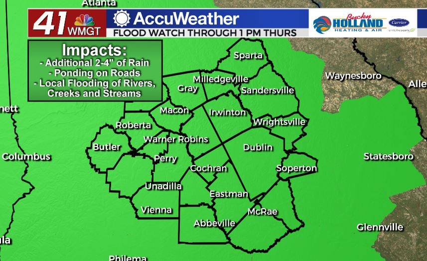
A Flash Flood Watch has been issued through Thursday afternoon. We are expecting additional rain chance to the point of localized and river flooding. As always, stay weather aware, especially if there is water across a roadway where you are driving.
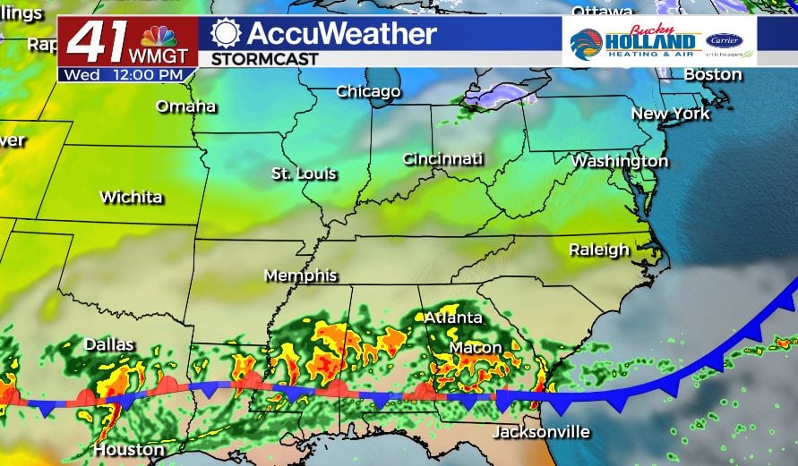
Today we saw a cold front drop in the area and with that, a few periods of heavy rain. Through the day on Wednesday a stationary boundary will inch closer to Middle GA and bring even more rain, and thunderstorm activity.
The threat for severe storms remains low, but not zero on Thursday. Have a way to get your warnings as we head into the evening.
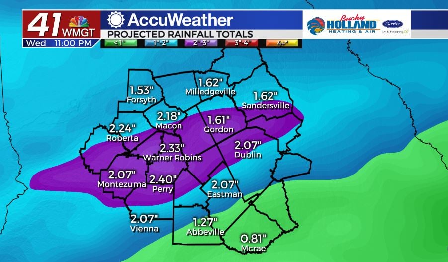
Heavy rain on Wednesday will add 1-2.5″ of precip over just the course of the day…there won’t be much in the way of breaks, so this is just kind of a place marker.
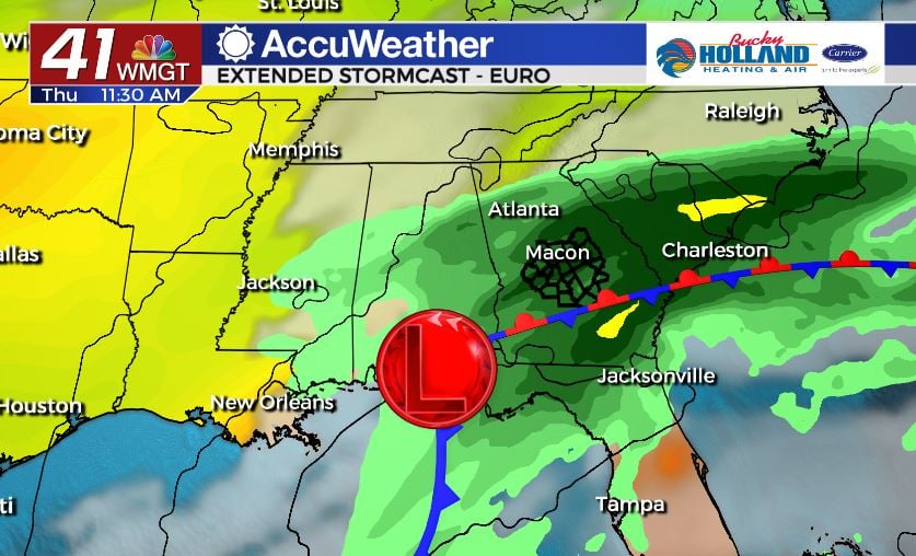
Rain will continue through the day on Thursday with the heaviest rain coming during the morning hours. As this low pressure system moves north rain will start to trail off and eventually we will start to clear out overnight Thursday.
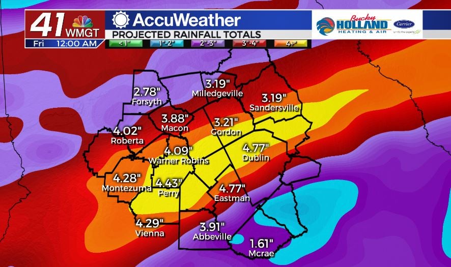
By the end of the entire event, we will pick up 3-5″ of rain, hence the Flash Flood Watch.
Pretty much, just strap in for more rain, drive slow, turn on your headlights.
The weekend looks great though! 🙂

Leave a Reply