
Afternoon shower and storm coverage will increase in coming days
MACON, Georgia. (41NBC/WMGT) – A ridge of high pressure currently has a strong hold on the eastern third of the United States, but this pattern will relax late this week and into the weekend.
TONIGHT.
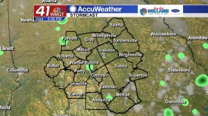
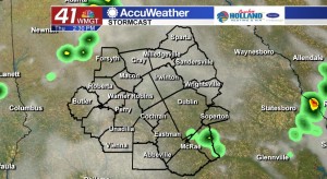
Any showers and storms that form this evening will be isolated and will dissipate quickly near sunset. After that you can expect a mostly clear sky with temperatures in the middle 70’s.
TOMORROW.
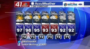
The upper 90’s return tomorrow afternoon under a mostly sunny sky. When you factor in the humidity it is going to feel like the triple digits in most Middle Georgia cities. Make sure to drink plenty of water and avoid the maximum daytime heating hours!
FOURTH OF JULY.
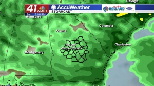
Better rain chances are moving in on Thursday afternoon and evening. Temperatures during the day will be in the upper 90’s under a partly sunny sky before scattered showers and thunderstorms form. Those with plans for fireworks will need to monitor the weather as some of these storms could linger into the late evening hours. This is a typical summertime pattern for Middle Georgia.
EXTENDED.
Beyond Thursday rain chances will be in the forecast every day with better chances of rain returning late in the weekend and early into next week. As the ridge of high pressure wears down temperatures will relax into the lower 90’s.
 Follow Meteorologist Dalton Mullinax on Facebook (Dalton Mullinax 41NBC) and Twitter (@MullinaxWX) for weather updates throughout the day. You can also watch his forecasts Monday through Friday on 41NBC News at Daybreak (5-7 a.m.) and 41Today (11 a.m.).


Leave a Reply