

Scattered showers stay in the forecast for the week
Tuesday:
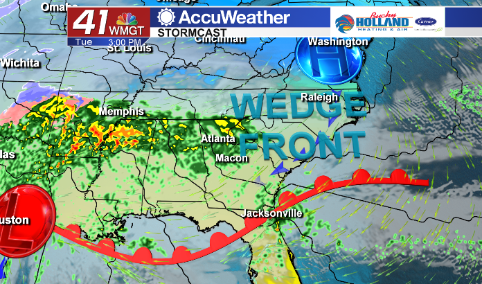
Tomorrow will likely be another cloudy and cold day across Middle Georgia thanks in part to a wedge front. This front will set up as high pressure to our northeast and push cold air through the mountains and down to Middle Georgia. This will mean highs will struggle to make it out of the 40’s and clouds and rain will hang around through much of the day.
Wednesday:
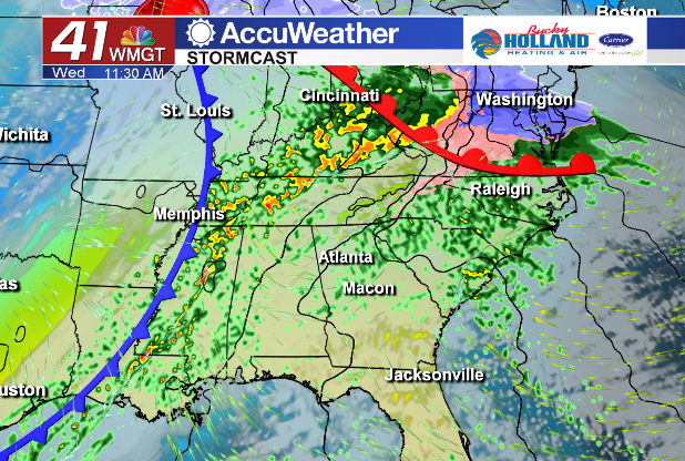
By Wednesday the high pressure moves further up the coast and mild air is back in the forecast through much of the rest of the week. Highs will climb into the lower 60’s and scattered showers will once again be in the forecast.
Rest of the Week:
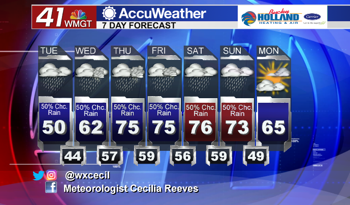
Scattered showers and a few chances for thunderstorms will remain through the work week and into the weekend. Temperatures will be back in the 70’s by the end of the week and our rain totals will stay relatively low (especially compared to far north Georgia and Alabama).
Rain Totals:
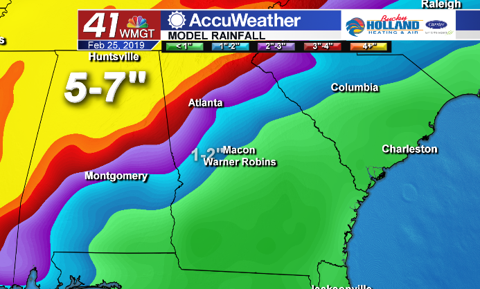
Flooding is likely in the far northern portion of Alabama and Georgia. Despite the impressive rainfall totals to our north, we will only see scattered showers throughout the week. Here in Middle Georgia our rainfall totals will likely top out around 2″ through the week.
Leave a Reply