
Cool, windy Wednesday in Middle Georgia
A cold front currently bringing snow and cold weather to parts of the Midwest is headed towards Middle Georgia for Wednesday.
This front will be losing most of its moisture on the way, so there won’t be any rain chances, but expect a big cool down and some gusty winds for the day.
Our cool down won’t be quite as dramatic as it has been out west, but we will see our high temps limited to the upper 60’s and low 70’s.
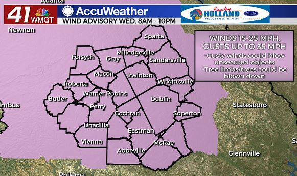
A Wind Advisory has been issued for all of Middle Georgia, beginning at 8 am tomorrow.
Winds will be staying pretty strong through the day with sustained winds of 10-15 mph and gusts up to 35 mph.
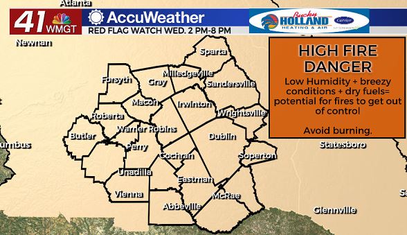
Couple those strong winds with low humidity and a lack of significant rainfall for a while and you get high fire danger as well.
Be sure to avoid burning tomorrow, and even be very careful where you put out cigarette butts etc.
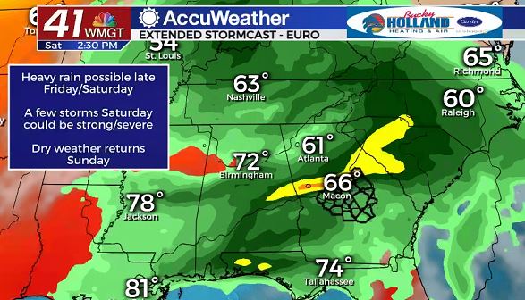
Weather should be pretty quiet through the end of the week with a slow warm up through Friday, but by Friday night, rain returns to the forecast.
This next system will be bringing the potential for (much needed) heavy rain to Middle Georgia as well as a few thunderstorms.
Some storms could become strong to severe, so we will need to be weather aware on Saturday.
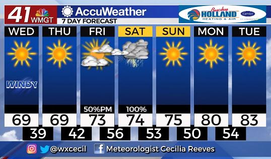
Rain will be quickly moving out Sunday with sunshine moving in for the end of the weekend and the start of next week.
Temperatures will warm to the 80’s for the start of next week, staying dry until the middle of next week.


Leave a Reply