


Strong storms possible Sunday
After a mostly dry day in Middle Georgia, rain is moving back in this evening.
A low pressure center in Alabama is bringing a chance of showers and storms to the area overnight. Severe weather is not expected with this round of storms.
Rain will be moving out by around 10am-12pm Saturday, so we should get a mostly pleasant day. Mostly cloudy skies will keep highs in the lower 70’s upper 60’s.
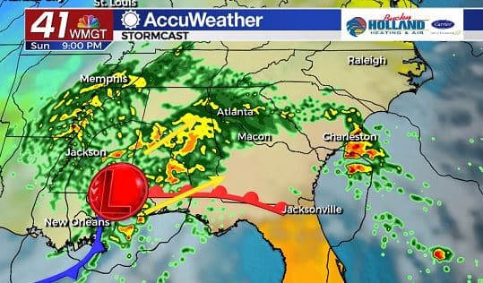
Sunday we will begin to watch our next system that could bring us heavy rain and strong/severe storms.
Low pressure will move north from the Gulf of Mexico bringing in more moisture and the potential for heavy rain beginning Sunday afternoon.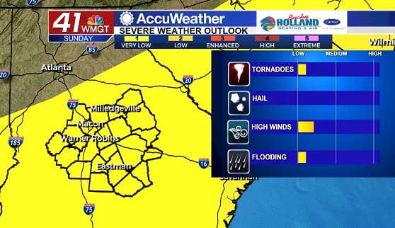
By Sunday evening we will be monitoring the possibility of severe storms across Middle Georgia due to the highly sheared environment.
Main threats for Sunday night into early Monday morning will be isolated tornadoes, damaging wind gusts, and heavy rain that could cause brief localized flooding.
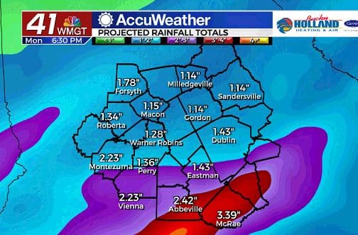
Rain totals through Monday could be rather impressive depending on the exact path of the low pressure.
Overall expect rain totals between 0,5″ to 2″ across Middle Georgia between now and Monday.
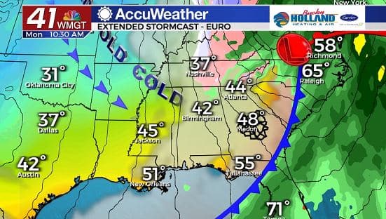
After the rain has moved out, we will quickly be ushered back into fall (but really winter). VERY cold air will be moving in through the day on Monday with breezy conditions hanging around as well behind the cold front.
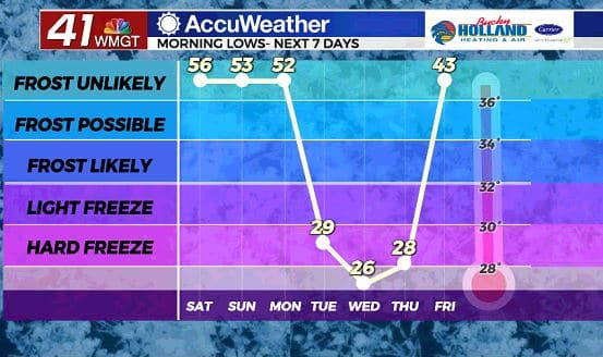
Lows will be dropping into the 20’s next week, which will result in a hard freeze for many of us in Middle Georgia.
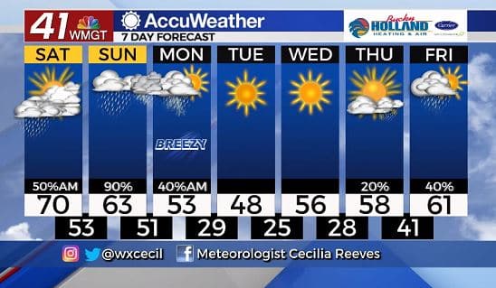
The coldest day of the week will be Tuesday, but by the end of the week, we warm back to the upper 50’s with plenty of sunshine.
Our next chance of rain holds out until the end of next week.

Leave a Reply