


Rain and warm weather return Wednesday
Clouds have started to move into Middle Georgia this evening, bringing warmer overnight temps.
We will be staying warm into tomorrow, when our highs will warm into the 70’s, even with cloudy skies.
A few showers will be possible mainly in the morning.
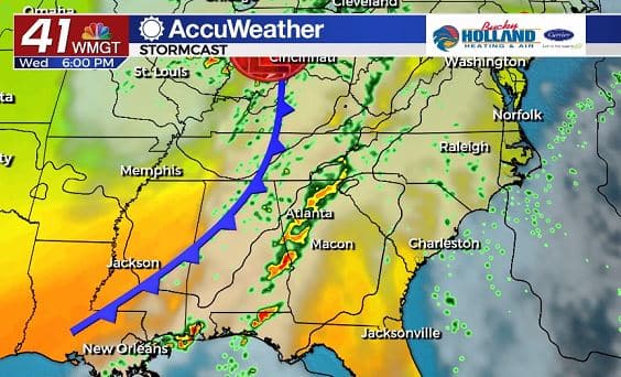
By tomorrow evening a cold front will move into the area bringing a chance for a few thunderstorms to the area.
Earlier in the day, those storms could become severe, but it is likely the instability will be pretty much gone by the time the storms reach Middle Georgia. We will be watching it closely.
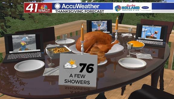
A few showers could linger into Thanksgiving day, but otherwise expect the cold front to stall over Middle Georgia.
Temperatures will still be pretty warm on Thanksgiving, with partly cloudy skies. A few thunderstorms will be possible.
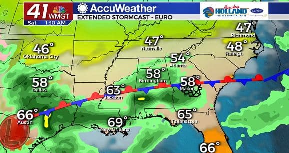
Over the weekend our rain chances will begin to increase. A stationary boundary will get stuck over the southeast.
Saturday might not be a total rain out, but expect some showers and maybe a storms.
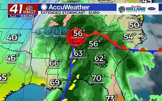
By Sunday, the likelihood of heavy rain will increase over Middle Georgia. At the moment the severe threat is limited, but we could see that change depending on the speed of the front and instability.
The biggest change this front will bring is a BIG cool down.
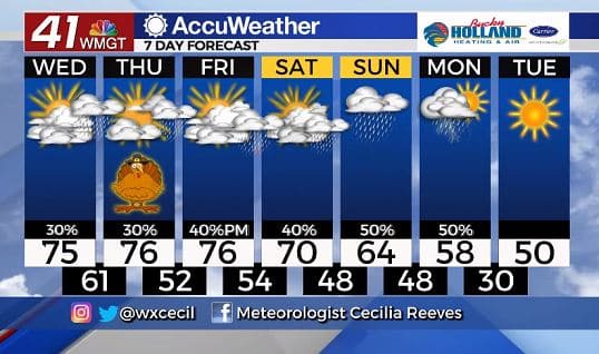
We finally get rid of the rain by Monday evening into Tuesday as the next cold front moves in.
Highs next week will be limited to mainly the 40’s and 50’s, with lows in the 30’s. Get ready to find your sweaters and flannel sheets!

Leave a Reply