Warm weekend on the way
After a few cool days, temperatures got back to the 70’s today. This is just the beginning, as more days in the mid 70’s are on the way for Middle Georgia through the weekend.
Saturday will be a beautiful day across the area, so get out and enjoy the day!
It is possible we could start out Saturday with some fog, but expect it to move out by late morning.
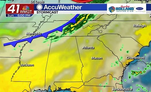
Sunday we will be between two different systems. To our southeast we will see the chance for some isolated showers to push in from the coast (just a 10% chance).
To the northeast we will be watching a cold front that will move into our area on Monday. Although this will be a dry front, we will see a bit of a cool down on Tuesday.
That cool down will be short lived, as we await our next system pushing in from the west.
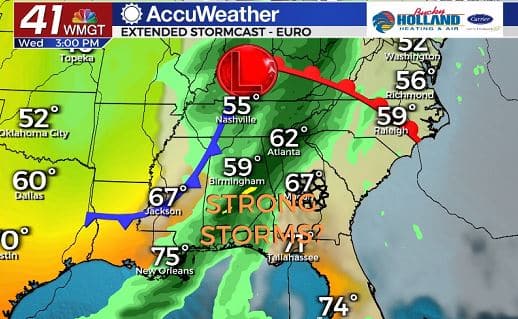
We are already monitoring the Wednesday cold front for the possibility of strong storms across Middle Georgia.
Timing will be key for our severe potential, so we will keep close tabs on this front through next week.
This isn’t sounding the alarm necessarily, but it is giving you a heads up that some storms could become severe.
Fall is our second severe weather season, so this isn’t unexpected.
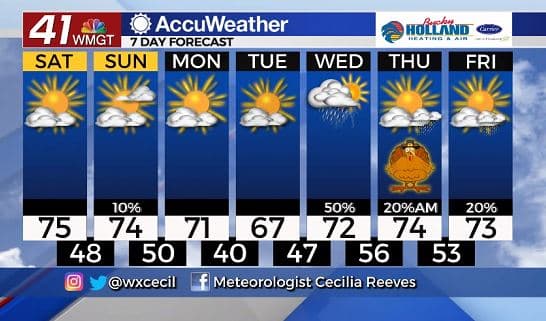
The severe threat will be gone by Thanksgiving Day, but we can’t totally rule out the chance for some isolated showers during the morning.
We are still pretty far out, so stay tuned for more forecasts ahead of the holiday.


Leave a Reply