


Staying warm for the weekend, showers possible
We have once again continued our trend of warmer than normal temperatures through the week. Highs today topped out around 78 in Macon, even with clouds hanging around.
Tomorrow will bring another day of partly to mostly cloudy skies and highs in the upper 70’s. A few showers will be possible tomorrow, but coverage should be relatively isolated.
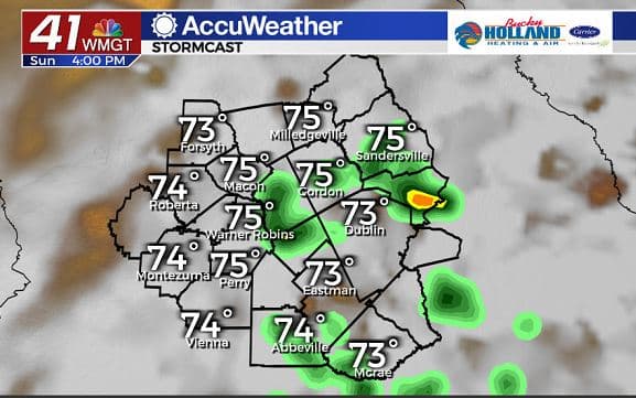
By Sunday, we will see essentially a repeat of Saturday, but with a few more showers possible. We will also continue to see increasing humidity through the weekend.
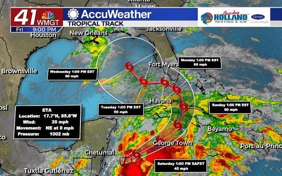
Over the weekend, Tropical Depression Eta is expected to strengthen back to a tropical storm. Eta is forecast to make another landfall in Cuba Sunday, before turning to the Gulf of Mexico.
NHC is relatively confident in the turn into the Gulf, but there are quite a few question marks afterwards.
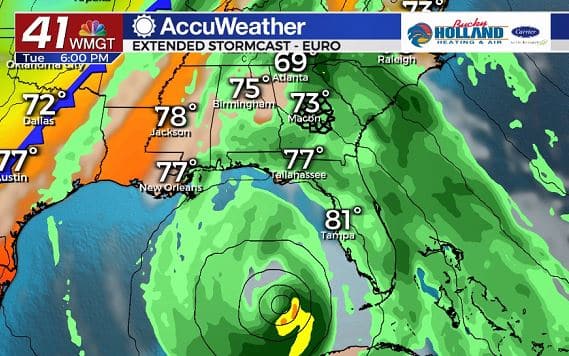
The European model suggests that Eta will meander in the Gulf for much of the week before eventually making landfall sometime late in the week.
An approaching cold front could absorb the system and usher it out of the southeast. Regardless, the main threats for Middle Georgia next week look to be mostly heavy rain.
So for now we wait and keep watching as Eta gets closer and we have better confidence in its track.
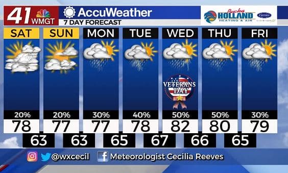
Highs through the next 7 days will be staying much warmer than normal. By the middle of the week will likely see our 80 degree days combine with tropical humidity, to make it feel pretty gross. Not only that we will likely start seeing some tropical downpours from Eta to go with it…so yeah, fun.
Anyways, hope you have a great weekend!

Leave a Reply