Staying warm Friday, with some clouds
Clouds and increased humidity have pushed in across Middle Georgia this afternoon and should be sticking around through tomorrow.
Highs tomorrow will be warming to the mid and upper 70’s with mostly to partly cloudy skies. Although we will continue our increase in humidity tomorrow, rain should hold off until the weekend.
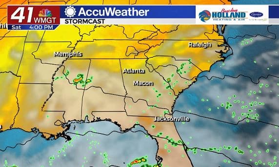
Much of Saturday will see cloudy skies, but by the afternoon a few showers and even a thunderstorm will be possible.
Highs through the weekend will continue to be in the upper 70’s while some southern counties could make it to the 80’s.

By the end of the weekend, all eyes are on the Caribbean where we are expecting Eta to regain tropical storm strength before making another landfall in Cuba.
There is pretty decent confidence that Eta will then recurve to the Gulf of Mexico. After that it is not so clear, but we will likely see impacts (at least indirectly) through next week.
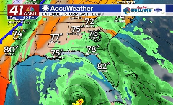
The European Model brings the Tropical Storm through the Gulf of Mexico and in doing so, showers and storms will increase through much of the southeast.
Tropical moisture will also be increasing through the week as Eta gets closer. Right now there is no reason to be worried about this system, but we will need to watch it closely next week.
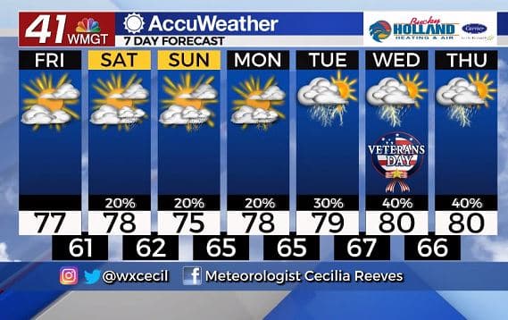
Main takeaway as we head into next week: temperatures stay much warmer than normal and rain chances increase as Eta gets closer to Middle Georgia.


Leave a Reply