


Another cool down on tap for Friday
We enjoyed a little warm up to the mid 80’s today in Middle Georgia, but that warm up will be quite short lived as we move into the end of the week.
Another cold front is pushing into North Georgia and will eventually make it to our area. This will be a dry cold front, so no rain is expected.
High temps tomorrow will be limited to the mid and lower 70’s, but sunshine will be plentiful.
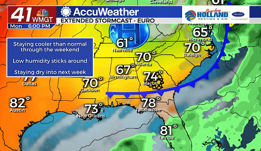
The weekend will bring more of the same with clear skies and low humidity. Highs will be staying mainly in the mid 70’s with lows dropping to the 50’s.
Yet another dry cold front is expected to move through Sunday into Monday, but don’t expect much of a change in temperature.
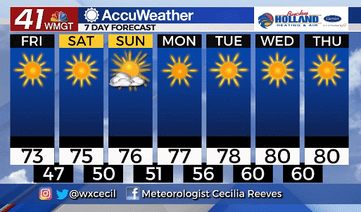
High pressure will move in behind the cold front and help to warm us back up to the 80’s. This is about normal for this time of year as far as temperatures are concerned.
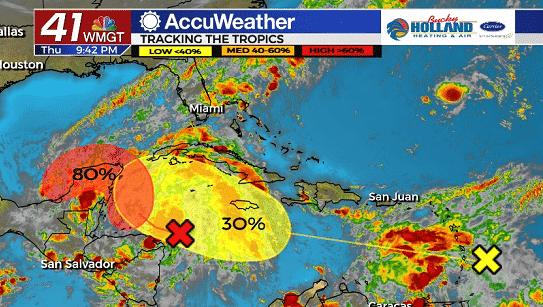
Although there is not much going on in our area, the tropics are getting a bit more active.
In the graphic above, the area in red is forecast to become Gamma within the next 5 days. The yellow X is forecast to push further west and right now has a low chance of becoming a tropical, but still bears watching through the weekend.
Middle Georgia isn’t in the immediate path of any tropical systems, but we will continue to monitor activity as it moves closer to the Gulf of Mexico.
Leave a Reply