


Weekend cold front brings drier weather and fall temps
It has been quite a weather week here in Middle Georgia, but with Sally gone, we will finally get some relief.
Tomorrow will bring a relatively boring day with clouds in place for much of the day and an isolated chance of a stray shower.
Highs will warm into the 80’s by the afternoon. Enjoy the warmth because a cold front will approach the area on Saturday.
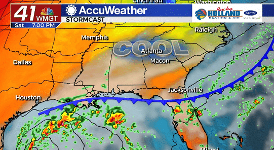
The cold front will move through during the day on Saturday bringing a big cool down. Highs will be limited to the low 70’s for the weekend.
Expect some breezy conditions as well as a chance for a few showers and maybe a thunderstorm. 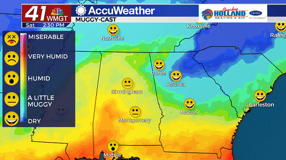
Dry air will filter in behind the front and bring a nice break from the intense humidity that we have been seeing ahead of Sally. I for one say good riddance to dew points in the 70’s (ick!)!
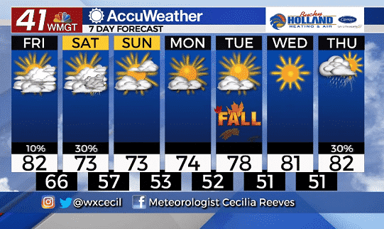
That fall feeling sticks around through the weekend and into the start of next week. High pressure is going to help to clear things out through the start of next week.
The first official day of fall will see temperatures well below normal for this time of year, but a warm up is on the way through the week.
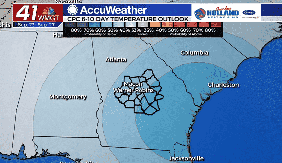
Looking ahead to next week, temperatures will be staying cooler than normal, with drier than normal conditions as well.
There is a new tropical depression that will bear watching through the weekend, but right now the forecast path would bring this system to Texas. Still lots of time to see what will happen, and hopefully we don’t see too much damage from TD 22.
Leave a Reply