


Rain chances and humidity return to Middle Georgia
This weekend and the past few days have been a really nice break from the summer-like trends we have been in for quite a while, but all good things must come to an end.
A tropical air mass will be moving in across the area overnight and into tomorrow morning. This will increase our humidity, cloud cover, and rain chances.
Storms will likely stay pretty scattered through the afternoon on Wednesday, but this is just the start for what will likely be a rainy weekend.
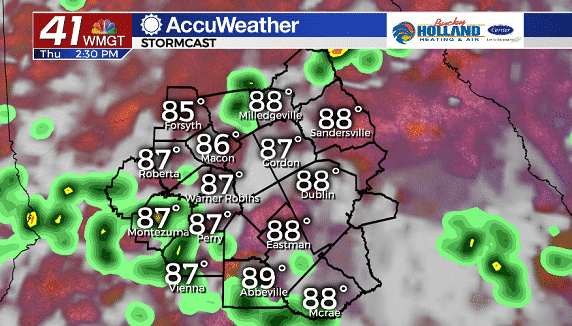
Thursday afternoon, rain and storms will be more widespread with highs staying in the upper 80’s. Heat index values will be in the mid 90’s with high humidity continuing through the rest of the week.
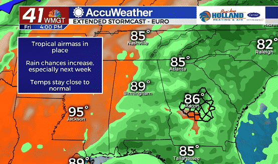
As we head into the weekend, a cold front will approach the southeast and it will bring an increase in rain chances. Unfortunately, the cold front will likely stall before it moves all the way through Middle Georgia.
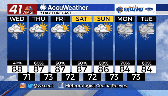
By next week we will see better chances of heavy rain which will keep us a bit cooler than normal, but don’t expect these cooler temps to last for too long.
Leave a Reply