Severe storms possible (again) Thursday
Alright, so I know we are all pretty tired of severe weather across Middle Georgia, but we have another round on the way Thursday.
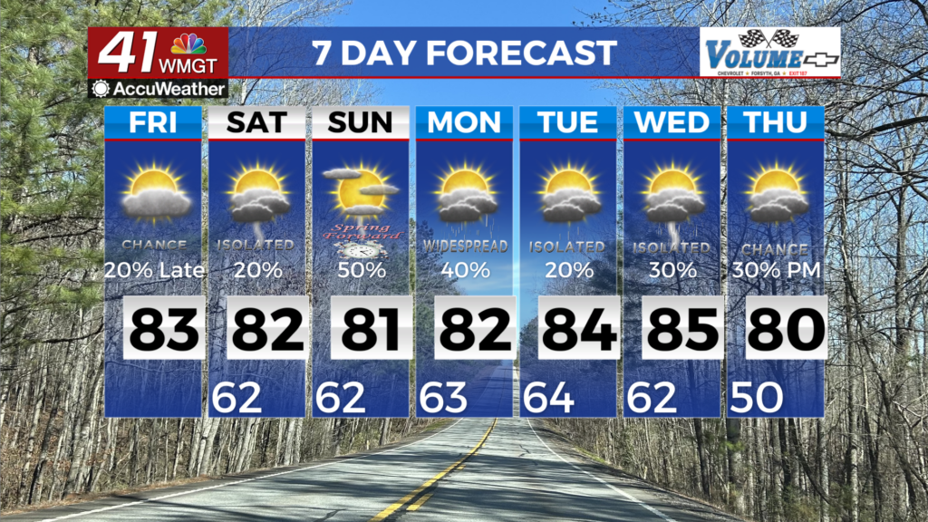
First things first: Tomorrow is Earth Day, and it will be a nice day with highs in the 70’s and mostly sunny skies. Now for the not so great news…
I will preface this post with the fact that at the moment there are a few more questions than answers as far as timing and intensity. That being said, we could see another really nasty day across Middle Georgia and being prepared will be key.
The Storm Prediction Center has already categorized us as under an “enhanced” risk of severe storms (level 3 of 5). Based on some of the things we are seeing in forecasts there is the possibility that this system will LIKELY BRING: heavy rain and damaging winds. We could POSSIBLY SEE: a few strong tornadoes and large hail.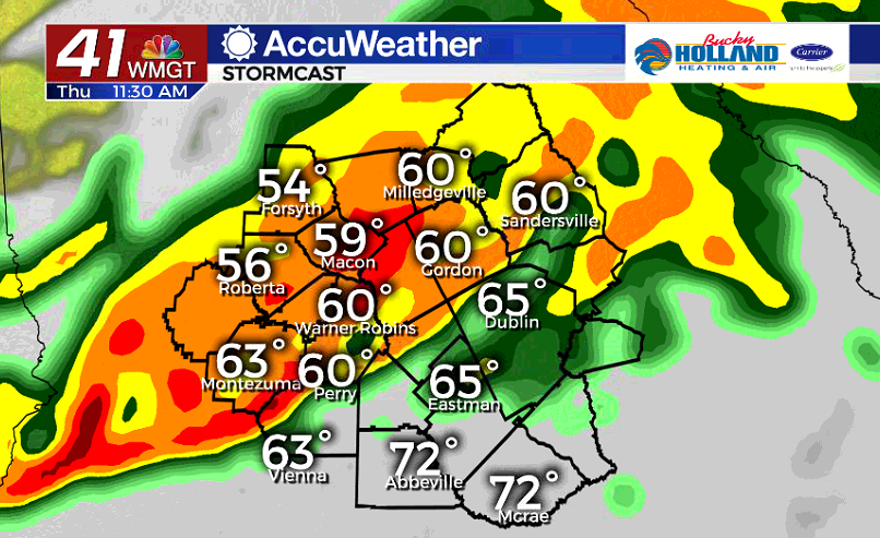
Several models start the timing for the threat during the morning hours, but this looks like an all day kind of threat in our area. Be ready to hunker down at home with multiple ways to get warnings throughout the day.
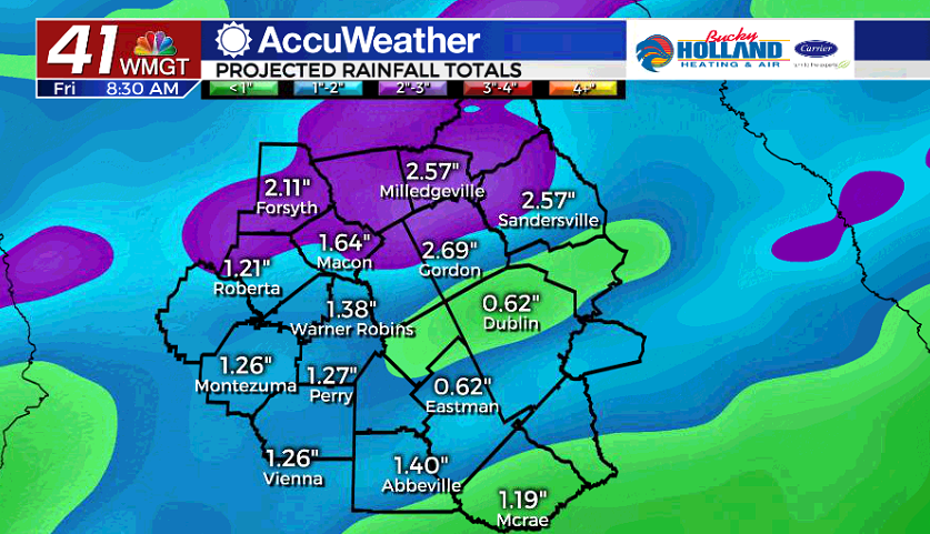
Rainfall totals will be back up to 2.5-3″, which means that we are looking at the possibility of more river flooding, localized flooding, and saturated soils (which coupled with strong winds could mean more trees down).
This is another one we are watching closely so stick with us as we get through this system with hopefully minimal damage.


Leave a Reply