
Severe storms possible in Middle Georgia this weekend
Well, we have had a beautiful day across Middle Georgia today, but we will see deteriorating conditions as we head through the weekend.
Severe storms are once again in the forecast and Middle GA is under the gun…once again.
Main threats for this system, for ALL OF MIDDLE GA, are damaging winds (70 mph winds), strong tornadoes, and flash flooding.
Saturday
Before we get too far into the severe weather rabbit hole, just know that although an isolated shower or storm is possible on Saturday, it should mostly be a nice day.
A front will be pushing through during the morning bringing breezy conditions, but other than that there really shouldn’t be any issues.
Sunday-Monday
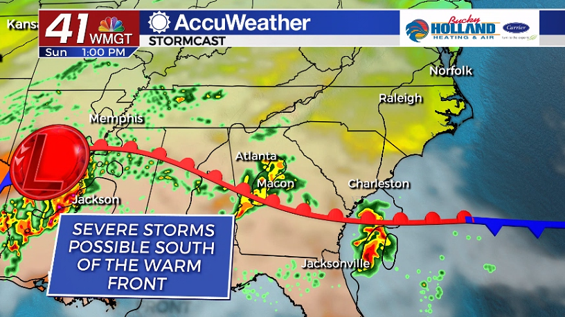
Starting Sunday morning we will see a warm front try and lift into the area. This will play a huge part in what kind of weather we see during the day.
To the south of the front we will see the best moisture as well as instability. This will be the best chance for supercells, that could spawn tornadoes as well as contain damaging winds.
We will consider this the first round. It could end up much like last week, when we didn’t really see discrete cells develop. That would be great, but we have to prepare for the possibility that these storms do fire early.
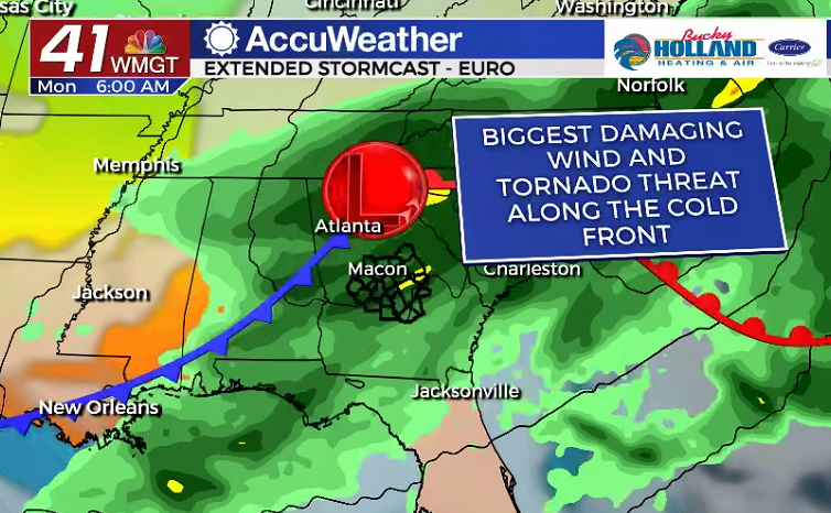
Likely we will get another break between the early activity and the line that moves through later in the evening. Timing looks like this last line (like last week) could move in after midnight.
Regardless the cold front will bring the best chance of very strong winds, especially gusts, as well as tornadoes.
This will be another instance to have a way to get your weather warnings that will wake you up!
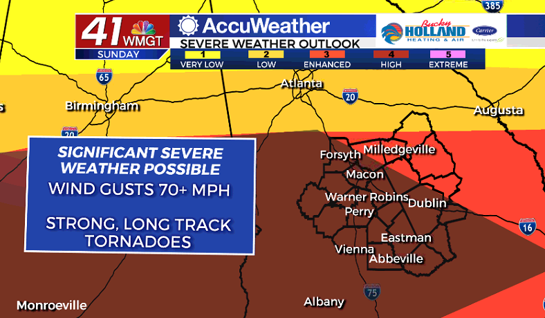
This darkened area on the map shows the areas that the SPC has outlined as having the greatest chance of “significant severe weather”. This means strong, long track tornadoes will be possible, as well as wind gusts over 70 mph.
This could mean another night/morning of significant power outages and trees down.
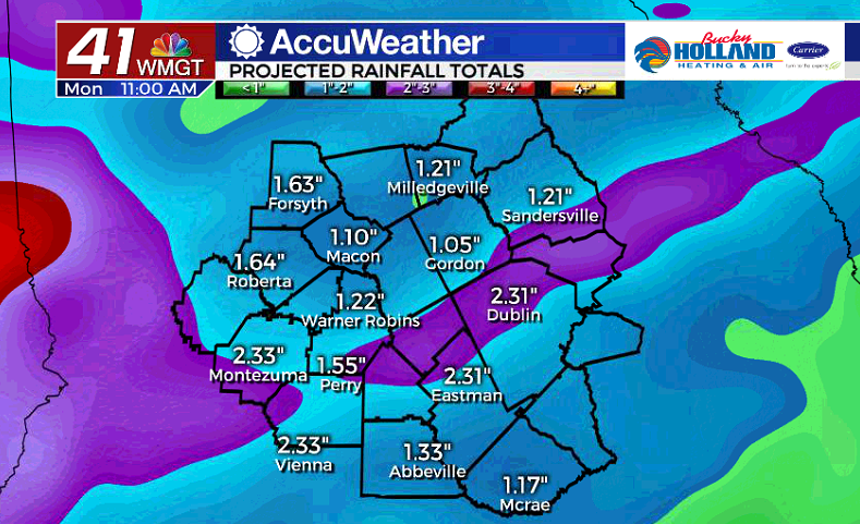
To make matters worse, we will also see an increased threat of flash flooding in the area. Some parts of Middle Georgia could see 3″ of rain in just a matter of hours.
Be aware this will also make it easier for trees to be downed with gusty winds.
Any ways, please pay attention to the forecasts between now and Sunday. I will be doing more posts and FB Lives and Dalton will as well.
We are in this with you, and will have all the updates so be sure to prep, have a way to get warnings, and stay weather aware.


Leave a Reply