


11 PM Update: Hurricane Michael continues to intensify, bringing threat of rain and wind to Middle Georgia
Good evening,
Hurricane Michael continues to strengthen as the storm moves farther north into the Gulf of Mexico.
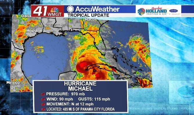
As of the 11 pm update from the National Hurricane Center, the storm has sustained winds of 90 mph and gusts of 115 mph. This continues the trend of intensification that we have seen with the storm over the past 24 hours.
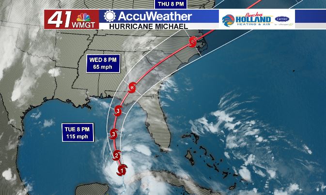
The latest forecast track for Michael still brings the storm into Middle Georgia overnight Wednesday into Thursday morning. This will likely be a storm with the worst impacts seen overnight on Wednesday.
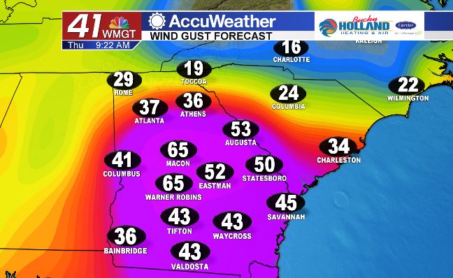
Tropical storm strength wind gusts will be possible across Middle Georgia during the time period from Wednesday evening into Thursday morning. Gusts of 30-60 mph are likely and some gusts could exceed those numbers.
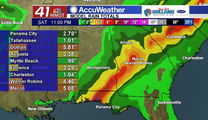
Heavy rainfall is also likely across the area. Macon and areas to the south could see rain totals from 3-6″, dependent on the final track of the storm.
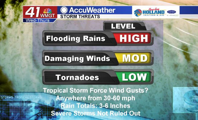
Not only are we watching carefully for flooding rains and damaging winds, isolated spin-up tornadoes will be possible in areas that are in the northeast quadrant of the storm. It should be noted that these forecasts are all preliminary and will be subject to change as the storm gets closer to land. Be sure to make your preparations now, before the storm moves in on Wednesday night.

Leave a Reply